

Journal of Creation 35(2):69–79, August 2021
Browse our latest digital issue Subscribe
An Upper Mesopotamian location for Babel
The authors follow three lines of evidence that all point to Upper Mesopotamia as the origin of human civilization and the most likely location of Babel. The lines of evidence are archaeological, biological, and historical. The evidence points to a specific site whose mound has never been excavated. This is the first of two papers that present evidence for a Babel site and an Ark site located 50 km apart near Diyarbakir, Turkey.
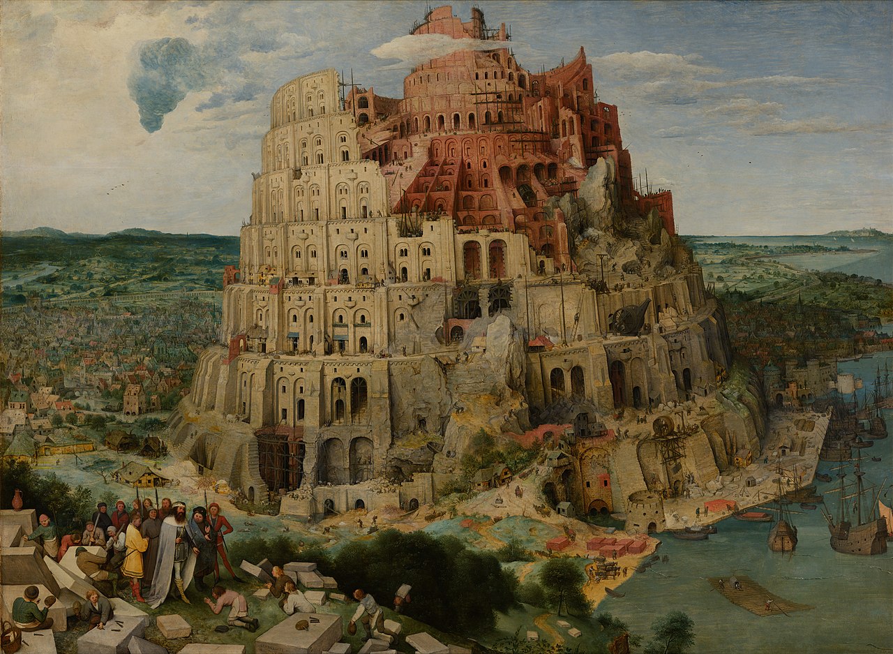
The Tower of Babel should be one of the most enduring monuments of antiquity. Unlike mud bricks which melt back into the earth when exposed to rain, the city and tower of Babel were built of fired bricks mortared with asphalt. Ceramics are able to resist the elements for tens of thousands of years. At the very least, the foundations of Babel should still be there today.
Though there are many local traditions, to date Babel has not been positively identified. Nearly every ruined ziggurat in the Middle East today is named after either Nimrod (Birs Nimrud) or some form of the name “barsip” which means “tongues” in Semitic languages.
Since Babylon is in lower Mesopotamia, and that is where the Jews were taken into captivity by Nebuchadnezzar, most historians have assumed that Babel and Babylon were the same city, or at least the same region. Thus, the Esagila of Babylon should be the tower of Babel, according to this view.
Archaeologists have found that Babylon was first built in the Akkadian era, centuries after the oldest cities of Sumer, making it one of the later cities built in the region of Sumer and Akkad. The biblical text tells us that Babel was the first of Nimrod’s cities in his first kingdom in the land of Shinar. This creates an apparent contradiction between the Bible and archaeology.
Nebuchadnezzar himself seems to have believed the ziggurat of Borsippa, 30 km south of Babylon, was the Tower of Babel. He renovated it and left foundation bricks telling how in previous times they had laboured building it for 42 years, or cubits, but left it unfinished.1
David Rohl made the case that Babel was the Sumerian city called Eridu, which lay 150 km south-east of Babylon.2 Douglas Petrovich seconded Rohl’s hypothesis in the video series, “Is Genesis History?”3 Thus, the emperor of Babylon at its apex (Nebuchadnezzar), and some scholars over 2,000 years later, share the opinion that the Esagila of Babylon was not the location of the Tower of Babel.
Sayce4 and Albright5 both suggested that Babel might be found in Upper Mesopotamia. More recently Habermehl6 made the case for the Khabur Triangle in Eastern Syria as Shinar.
In this paper we will present evidence suggesting that there were two Babylons, though not in the sense of Hislop. The Babylon of Nebuchadnezzar was the second Babylon, in a similar sense that the York on Manhattan Island is New York, not the original York in Northern England.
There are biblical, historical, and archaeological witnesses that point to where the original Babylon lay. If we follow them, they point to a specific site which has never been excavated.
What is known
The biblical narrative relates that after the Flood the descendants of Noah began to build a city and tower called Babel, which was to be a tower “reaching to the heavens” for the purpose of making a name for themselves (Genesis 10–11). After the confusion of tongues mankind dispersed from Babel and formed the nations of the world. However, the Babel event of chapter 11 appears to be out of sequence, and must have occurred prior to the migrations to the territories of the nations recorded in chapter 10.
When early archaeologists, adventurers, and treasure hunters began to dig up the Middle East in the 19th century, they found cities, temples, and ziggurats with writing on clay tablets. These were determined to be some of the oldest cities in the world.
The oldest cultural layers of Sumer and Akkad are defined by archaeologists as the Ubaid, Uruk, and Jemdet Nassar Periods. These were the earliest urban periods in lower Mesopotamia. However, they are not the oldest urban settlements on the planet. That distinction belongs to a culture that Kathleen Kenyon defined as the Pre-Pottery Neolithic A, or PPNA.7
The Neolithic is defined as being younger than the Paleolithic and Mesolithic cultures, which did not build permanent settlements or practise agriculture. However, this seems to be an unfounded assumption of evolutionary thinking. The unquestionable premise of evolution is that man was a hunter gatherer before he became a farmer. Therefore, the widespread campfires and burial caves of the Paleolithic hunter gatherers must be older than the Neolithic, including the PPNA.
However, ceramics including pottery have been found at Paleolithic sites on the Adriatic, as well as in China, and Japan. In the biblical narrative we see farming and city building with fired bricks immediately after the Flood. Therefore, a biblicist might conclude that Paleolithic and Mesolithic hunter-gatherers were actually a parallel culture or mode of living that was mostly after the Dispersion, and therefore concurrent with or after the PPNA.
The Bible states that Noah was the first farmer after the Flood (Genesis 9:20). In archaeology the ‘Neolithic’ are considered the first farmers, and the PPNA is the oldest known Neolithic culture. Therefore, we expect that the PPNA is a good place to look for the Tower of Babel.


The PPNA sites are located in the mountains and valleys of upper Mesopotamia (figure 1). There are no known PPNA sites in lower Mesopotamia where Babylon lies. This poses a major problem for the conventional understanding of Babel. However, there are intermediate settlements called the Hassuna and Samara cultures going down the Tigris River from the PPNA toward the later Ubaid culture of Uruk (figure 2). Smith asserted that Çatalhöyük, a PPNA site, was one of the first cities built after Babel,8 which agrees well with our thesis that the PPNA represents the culture of Babel and the two centuries immediately after the dispersion.
Returning to the biblical narrative, let’s make a list of the features that we are told about Babel, and we can consult some other sources as well.
We are told that Babel was the first of four cities in Nimrod’s first kingdom, and that it was on a plain called Shinar. The four cities were Babel, Erech, Accad, and Calnah (Genesis 10:10).
From four extra-biblical sources including the Sybils, Polyhistor, Abydenus, and Jubilees, we read that the construction of the tower was stopped by a terrible wind.9,10 The Midrash, another ancient source, states: “As for the unfinished tower, a part sank into the earth, and another part was consumed by fire; only one-third of it remained standing.”11 These traditions could be a reference to volcanic activity near Babel such as a pyroclastic flow accompanied by an earthquake.
Humphreys12 argued that the city of Babel lay on an east-west axis with the ark, based on the frames of reference in Genesis 9 and 11. Since the city and tower were built with burned bricks, then we might expect to find a kiln where the bricks were fired. The use of bitumen requires a local source of tar or trees from which plant-based bitumen was derived.
We can build a list of features that we will expect to find at the Babel site:
- Situated within the oldest urban cultural layers on Earth
- At the centre of the dispersion of nations
- Near the centre of the first Neolithic farming
- On a plain called Shinar (“Shee-nar” in Hebrew)
- Four associated cities: Babel, Erech, Accad, and Calneh
- Evidence of firing bricks in a kiln
- Local source of tar
- Structures made of fired brick and asphalt mortar
- On an east-west axis relative to the Ark or Altar site
- Possible volcanic activity.
Lastly, we might expect that Babel may have been reoccupied after the dispersion event. It was an excellent location, and it already had kilns as well as houses and other city infrastructure made of fired bricks that could not be carried away. Whichever tribe stayed behind and claimed that valley after the others had dispersed would have found Babel to be low hanging fruit for resettlement.
Archaeological and biological evidence
Looking at the map of the sites of the Pre-Pottery Neolithic A (figure 1), we find a distribution with three horns, roughly centred on the city of Diyarbakir, Turkey. The three horns go out from the centre: west along the Mediterranean coast to the Aegean, southwest to Canaan, and south-east along the Zagros mountains toward what would become Elam and today’s Iran. There are also a few outliers in Upper Egypt. The centre of the PPNA distribution is on the bend in the Tigris River just south of Diyarbakir, Turkey. This suggests that the region of Diyarbakir might be fruitful to investigate for evidence of Babel.
Biological evidence
The oldest biological ancestors of einkorn wheat, emmer wheat, barley, peas, chickpeas, lentils, and flax are all found with similar distributions. These were the founder crops of the ‘Neolithic Revolution’. Their distribution is roughly centred on the mountain called Karaca Dag (pronounced “karaja dah”), which is about 30 km west of Diyarbakir.13 Weiss’s paper has seven more maps similar to figure 3 for the other seven founder crops.

Note that the ‘fertile crescent’ for the neolithic founder crops does not include the plain of lower Mesopotamia where Babylon is located. The alluvial plain of Lower Mesopotamia may have still been part of the Persian Gulf for several centuries after the Flood.14
Archaeology and biology both suggest that the origins of human civilization and farming began between the Euphrates and Tigris rivers in the region of Diyarbakir, Turkey. For now, we will not be concerned with radiocarbon dating suggesting these sites are 10,000 years old. If we ignore the conventional chronology which may be based on mistaken assumptions, we find the evidence fits the biblical narrative quite closely.
Sargon’s conquest of a northern ‘Babylon’
Sargon of Akkad recorded his relocation of a city named ‘Babylon’ in the region of Diyarbakir, Turkey as part of his defeat of Subartu. He was one of the early empire builders, though we disagree with those who identify him as Nimrod.15 In the ashes of Sargon’s destruction of Ebla were found pottery with the cartouche of Pepi I of Egyptian Dynasty Six.16,17 Given Pepi’s place in the Memphite dynasties of Manetho, this places Sargon more than five centuries after the dispersion.
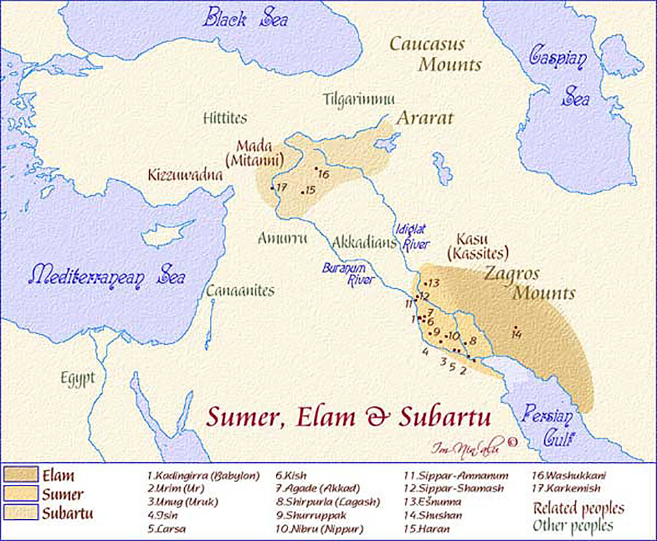
Sargon’s home of Akkad is believed to have been in the region of Iraq near Babylon, and there is some evidence that Akkad was simply the original name for the city of Babylon. Sargon campaigned to the Mediteranean Sea and sacked the cities of Mari and Ebla en route. He also made a campaign northward into a place called Subartu. There he claimed that he dug clay from the pit of Babylon and then made a new Babylon next to his city of Akkad in Lower Mesopotamia.18 Thus Sargon claimed to have moved Babylon from Subartu to Akkad. Subartu was the region at the centre of the PPNA distribution, centred on the valley of the upper Tigris River. The modern city of Diyarbakir is situated near the centre of ancient Subartu (figure 4).
Clues from the biblical text
Three biblical texts speak to the location of Babel. These are the territories described in the Table of Nations (Genesis 10), the description of Babel itself (Genesis 11), and the description of Nimrod’s first and second kingdoms (Genesis 10:10–12).
Territories of the Table of Nations
Genesis 10 describes the spreading out of the tribes after Babel, but it specifically describes the territories of one of the descendants of each of the three sons of Noah, as if these tribes were representatives of the larger group. The representative of Shem was Joktan, Ham is represented by Canaan, and Japheth by Javan. We know that not all the Japhethite tribes went west, and not all the Shemite tribes went East. This suggests that this list was made at a moment in time when Javan, Joktan, and Canaan were the first movers from their respective groups. The remainder of the tribes may have still been lingering in the central area before migrating out behind them. Another possibility is that the author of Genesis 10, living near Haran, only recorded the territories of tribes that were personally known to him.

If we compare the map of the PPNA to the territories of Genesis 10, we find that they match very closely (figure 5). The territory of Joktan was described as being “from Mesha toward Sephar, the great mountain of the East.” We don’t know for certain where Mesha or Sephar were located, though Mesha could be a reference to the Akkadian “Mashu” where the Ark landed. The eastward horn of the PPNA follows the Zagros Mountains toward Iran in the East. It is a better fit than any other information we have at this time. And incidentally, with a lower sea level, this also would have been on the way to the Eastern Arabian Peninsula where some Joktanite towns are believed to have been.19
Nimrod’s two kingdoms
We learn from the Table of Nations in the 10th chapter of Genesis that Nimrod built four cities in the region of Babel and then he “left that land” and built three or four more cities in Assyria.
“Cush begot Nimrod; he began to be a mighty one on the earth. He was a mighty hunter before the Lord; therefore it is said, ‘Like Nimrod the mighty hunter before the Lord.’ And the beginning of his kingdom was Babel, Erech, Accad, and Calneh, in the land of Shinar. From that land he went to Assyria and built Nineveh, Rehoboth Ir, Calah, and Resen between Nineveh and Calah (that is the principal city).”
If we assume that Babel was the same city as Babylon then Nimrod’s new cities in Assyria would have been upstream of Babel. However, the first clue that the conventional understanding of Babel in lower Mesopotamia might be wrong is that Nimrod’s Assyrian cities are listed in order going downriver, not upriver.
Nineveh is the northernmost of the Assyrian cities, Calah is 30 km south, and Resen was between them. Rehoboth Ir has not been found. If the order of cities is a directional clue, then we should look for Babel in a plain once called Shinar that is upstream of Nineveh.

Of the five plains in Mesopotamia there are two that fit this description: Çınar (chee-nar) on the upper Tigris River near Diyarbakir, Turkey, and the Khabur Triangle of north-east Syria (figure 6). The name “Shinar” may have been applied to a large area of the land between the rivers, or several places. By the time of the Jewish captivity, which was at least 1,600 years after the Dispersion, Sumer was considered to be part of Shinar as well. (Daniel 1:2; Zechariah 5:11)
Genesis 10:10 tells us that Nimrod’s first kingdom had four cities: “Babel, Erech, Accad, and Calneh”.
In the plain where Babel was located, we should find three more ancient cities originally named Erech, Accad, and Calneh.
The Hebrew Shinar is pronounced “shee-nar”. The name may not have survived to the present day, or it may only be found in parts of the region it originally described.

However, there is to this day a village and province in Turkey called “Çınar”, pronounced “chee-nar”, nearly identical to the Hebrew for Shinar. Figure 7 shows a detailed map of the region of Subartu in Upper Mesopotamia. Çınar is the fertile plain on the south side of the Tigris River. The name “Çınar” in Turkish and Persian means “plane tree”. However, this region has been primarily inhabited from antiquity by non-Turkic tribes such as the Kurds, Armenians, and Assyrians. The region of Çınar today is not known for trees at all, but it is a flat plain and the richest agricultural land in Turkey.

As we zoom in on this region, we find that it meets all the criteria for Babel and Nimrod’s first kingdom of four cities in the land of Shinar.
Here is a village and province called “Çınar” (chee-nar) which is located on a fertile plain bisected by the Tigris River. There are four ancient tels along the Tigris River, two of which appear to have retained some form of the original names until at least Neo-Assyrian times, and one of them until today. The preservation of one name alone would not be a very strong case. The preservation of three names, Shinar, Erech, and Calnah makes a much stronger case that this is the correct location. Figure 8 shows our candidate sites for the first kingdom of Nimrod in Çınar.
The name of Cain’s first city was Enoch (Genesis 4:17). The name of Nimrod’s second city, Erech, appears to be named after Enoch, as Uruk was also called Unug by the early Sumerians. Tiglath Pileser I (1076 BC) recorded his campaigns in this region, which he called Kirhi, near the mountain of Hiriki which is also the ancestral name of the mountain Karaca Dag.19,20 This word, Hiriki, appears to be derived from the biblical Erech. It was called Kurkh by Shalmaneser III several centuries after Tiglath Pileser I called it Hiriki. Nimrod’s city of Erech may be the tel in Uctepe at 37049’34.70”N, 40032’21.80”E. Today the “Uc” in the name preserves the remnant of the original Erech. We would argue that about a century after the dispersion some of the residents of the original Erech followed the Tigris river to Sumeria, and built the city called Uruk.
We have an inscription from Ashurnasirpal II, the predecessor of Shalmaneser III, in which he describes cities in this valley that he conquered:
“By the valley of Khulun, I entered the country of Kirkhi. I conquered the land of the Hittites, Khataru, Nistun, Irbidi, Mitkia, Arsania, Zila, Khalua, all Kirkhi cities, found between Usu mountains, Arua and Arardi. I have made a large number of slaves and I took their property. Their troops were frightened and retreated to a peak in front of the city of Nistun, which emerged from the sky like a cloud. … Bubu son of Babua, the master of Nistun, in the town of Arbela, I revetted the walls with his skin.”21
This inscription is notable because it seems to record three Bible names associated with Genesis 9 and 10: Khulun, Kirkhi, and Arardi would be Calnah, Erech, and Ararat or Urartu. Assyria contended for centuries with the city of Hattusa (the “Hittites”) in Anatolia for control over the region between the Upper Tigris River and the western bend of the Euphrates. The fact that Ashurnasirpal calls this valley “the land of the Hittites” means that it had been under their control for some time prior to his campaign.21
The city “Khulun” that Ashurnasirpal mentions could be Nimrod’s Calneh. He says he entered the region by the “valley of Khulun”. If Ashurnasirpal followed the Tigris River up from Assyria, then Khulun/Calnah would be the first city encountered after emerging from the Tigris gorge onto the plain of Çınar.
Tentative sites for Nimrod’s kingdom
We considered the following tentative sites for the four cities of Nimrod’s first kingdom in Çınar.
Babel candidate sites:
- Small structure under lava flow: 37040’27.62”N, 400 2’13.81”E
- 600 × 1000 m rectangle canted 230 east of north: 37044’57.88”N, 400 6’30.17”E
- Tel along old river terrace: 37047’48.84”N, 40022’45.39”E.

Erech:
- The mound of Kurkh: 37049’30.44”N, 40032’26.63”E (figure 9).
Akkad, later called Tusshan:
- 37047’37.96”N, 40047’30.28”E
- 37045’13.51”N, 40055’24.03”E.
Calneh:
- The last tel along the river before it enters the gorge: 37047’54.18”N, 40056’55.25”E.
Geological features


The Çınar region has a geological feature that could also explain the “terrible wind” that burned the Tower of Babel in the Book of Jubilees and other legendary sources. The mountain west of the site is Karaca Dag, an extinct shield volcano. However, there is one small cone on its eastern flank that erupted more recently. A lava flow believed to be in historical times flowed 20 km toward candidate site C and stopped about 10 km short (figure 10). If it was associated with a pyroclastic flow, which is a violent and scalding hot airborne current of ash, it certainly could have been perceived as “a burning wind” which gave an additional incentive for the people to flee the Babel project. We do not presently know when this eruption occurred, so the idea that it coincided with the dispersion is mere speculation until further studies can be made.
Figure 11 shows a 1998 map of oil and gas exploration in Turkey from the Turkish oil producer, Guney Yildizi Petrol Uretim. The Tigris River valley near Diyarbakir is the location of many oil and gas wells, indicating there was almost certainly a local source of tar bitumen there in the past.
Abraham two centuries after the dispersion
Another biblical clue is Abram’s birth in Ur of the Chaldees, and his move to Haran with his father Terah. It seems to be universally accepted that Haran in Turkey was the Haran of Terah and Abraham. However, Leonard Woolley, a ‘local flood’ advocate and archaeologist who dug at Ur in the 1920’s, popularized the Ur in lower Mesopotamia as the place where Abraham was born.
Cyrus Gordon later showed from the Mari and Ebla tablets that Urfa north of Haran was referred to as ‘Ur Kasdim’ which is Ur of the Chaldeans.22 The Chaldeans may have migrated down the Euphrates in the centuries that followed, but in Abraham’s time at least some of them were still in southern Turkey. It can be seen from the Assyrian annals that the Chaldeans did not start gaining control over Babylon until late in the Divided Kingdom era.23
Urfa and its closely associated Göbekli Tepe site are relatively near the centre of the PPNA culture. They are on the opposite side of the mountain Karaca Dag from Çınar. Following the Wiseman hypothesis that Genesis was written as a series of tablets by the witnesses to those events, we might conclude that Terah wrote the tablets for Genesis 10 and 1124 and that his family was with the tribe of Arphaxad in the area today called Sanliurfa, formerly ‘Urfa’. The name Arphaxad can be also represented as urfa-ksad(im), from which the name of the city ‘Ur Kasdim’ appears to be derived.22
Contrary to the consensus of scholars since the 19th century that Abraham was a contemporary of Hammurabi of the Middle Bronze Age, this would imply that Terah recorded his snapshot of the post-Babel territories toward the end of the PPNA period. This is not incompatible with the creationist stratigraphy of Osgood who places Abraham as a contemporary of the Ghassul culture in Palestine.25 The Ghassul culture was in the transition from Neolithic to the Bronze Age in Palestine that is called ‘Chalcolithic’, which means they used a mixture of copper and stone tools.
Wood places the destruction of Sodom, when Abraham was 99, at the end of Early Bronze III.26 Due to the conflicting claims of Wood and Collins we are unconvinced that anyone has identified Sodom with sufficient confidence to pinpoint the date of its destruction, much less to impose that date upon the life of Abraham.
In light of the ‘mushroom’ theory27 that transitions of metal technology occurred at different places and cultures at different times, we might postulate that Terah wrote his account of the territorial division early in his lifetime at the close of the PPNA, possibly from a list made by his father, Nahor; while Abraham lived long enough to see the EBII in Southern Palestine. Given the 305 years that passed, and the 700 km of distance between the birth of Terah and the death of Abraham, there was sufficient time and distance for cultural transitions from the PPNA to EBII in the lifetimes of Terah and Abraham.
The behaviour of Nimrod might explain stark differences in metal technology between different groups in the Middle East in the centuries after the dispersion. The Bible states that Nimrod built Nineveh (Genesis 10:8–11). Diodorus quotes Ctesias that Ninus built the city Nineveh and named it after himself.28 Beginning with Pseudo-Clement it was the opinion of the early church fathers that Ninus was Nimrod.29
According to Trogus Pompeius:
“Ninus, king of the Assyrians, first of all changed the contented moderation of the ancient manners, incited by a new passion, the desire for conquest. He was the first who carried on war against his neighbours, and he conquered all nations from Assyria to Lydia, as they were as yet unacquainted with the art of war.”30
It is interesting that the region that Pompeius says Ninus conquered corresponds exactly to the Taurus Mountains and the region of the PPNA. If Nimrod had confiscated all of the metals at the time of Babel and in his post-dispersion campaign to conquer Anatolia, then we might expect to see Hamitic cultures advanced in technology living next to now-impoverished Neolithic tribes of Shem and Japheth.
An Upper Mesopotamian Babel would also make sense of the battle of Chedorlaomer’s forces against the kings of Sodom and Gomorrah. Chedorlaomer’s coalition was composed of kings of Shinar, Ellasar, Elam, and Javan. The Hebrew word translated ‘nations’ for Tidal’s kingdom is Goyim (Genesis 14:2, 9), which is the plural of the name Javan, which is also the source of the Greek word ‘Ionia’. Elam and Ionia in later times were over 1,700 km apart. However, if Chedorlaomer’s campaign occurred at the time of the transition from PPNA to the Chalcolithic, then all four of those tribes might have still been dwelling near each other in the region of Subartu. This is also seen by the fact that after their victory and after Abraham’s night raid, they fled due north toward Haran, not east toward Sumer. This suggests that they came from the north.
The chronology and stratigraphy of Palestine and the ME was largely based on the 19th century assumption that Hammurabi was Amraphel, and therefore a contemporary of Abraham. That assumption has been known to be false since 1930.31 If that is incorrect, then the chronology resulting from that assumption is also likely to be in error. Osgood proposed an alternate stratigraphic chronology in his paper “The Times of Abraham”24 that supports our findings. He placed Abraham’s time in Canaan in the Chalcolithic and the early Canaanite period down to the Exodus in the Early Bronze Age.
Site investigation
In November 2019 the authors took a small team to Diyarbakir, Turkey, and visited all three of the candidate sites for Babel, as well as the mound of Kurkh. We were able to rule out Babel candidate A as an extinct volcanic vent. We did not find any ceramics on the surface of candidate site B, but we cannot rule it out as a candidate for the tower itself without taking core samples.
&copu; 2020 CNES/Airubs, © 2020 Basarsof

Babel candidate site C turned out to be a classic tel with ceramics strewn around on the surface (figure 12). A short distance from the mound is a recent quarry, now a seasonal pond, dug since 2004 in an area where the topsoil appears to have been excavated in the past.
There are three ancient sources that say that Sargon dug dirt from the pit of Babylon and built a new Babylon opposite Akkad. We do not know if “the pit of Babylon” was a clay pit, or perhaps an ash pit beneath the altar of a shrine.
The tablet known as ABC 20 “The Chronicle of Early Kings”32 relates Sargon’s last campaign of conquest to Subartu as follows:
“Afterwards, Subartu attacked Sargon in full force and called him to arms.
Sargon set an ambush and completely defeated them.
He overpowered their extensive army
and sent their possessions into Akkad.
He dug up the dirt of the pit of Babylon and
made a counterpart of Babylon next to Agade.”
Later interpreters gave a different version of the story in ABC 19, “The Weidner Chronicle”:29
“Sargon did not change but was careful to offer … quickly to Esagila
Marduk, the king of the world, favored him and gave him the rule of the four corners of the world.
He took care of Esagila. Everyone who sat on a throne brought his tribute to Babylon.
Yet he ignored the command Bêl had given him. He dug soil from its pit
and in front of Akkad he built a city which he named Babylon.
Enlil changed the order he had given and from east to west people opposed him. He could not sleep.
Naram-Sin destroyed the people of Babylon,
so twice Marduk summoned the forces of Gutium against him.
Marduk gave his kingship to the Gutian force.”
The Weidner Chronicle and the Curse of Agade17 both interpret Sargon’s digging dirt from the pit of Babylon as being a sacrilege against the altar of the only Babylon they knew, whose temple was called the Esagila. That is the Babylon we know today, located south of Baghdad in Iraq.
However, we see a different solution to the puzzle. The Chronicle of Early Kings relates that Sargon dug dirt from Babylon and built a new Babylon near Akkad in the section describing how he looted and humiliated Subartu after defeating them.
All three of the candidate sites we have identified are located near the centre of Subartu.
Based on Sargon’s correlation with Pepi I, Sargon reigned, at minimum, five centuries after the dispersion. We suspect that when he conquered Subartu, Sargon dug earth from beneath the altar of the shrine, and he ‘made a new Babylon’ which was a shrine to Bel Marduk just outside the walls of his city of Akkad. That new Babylon is the city known as Babylon today. Babylon has been determined to have been founded in the Akkadian era. Babylon, in our view, was Sargon’s hometown of Akkad. However, the region of Akkad was overrun by the Guti barbarians a generation after the time of Naram Sin, the great-grandson of Sargon.
Centuries after Sargon’s death, the legendary Semiramis II of Assyria is alleged to have ended the Arab Gutian dynasty by conquering the region of Akkad. She then allegedly upgraded the shrine village of Babylon and built walls around it.9 The authors are aware that Semiramis II is unattested by archaeological records, as are most biblical characters. We would identify her as the wife of Tukulti-Ninurta I, who was the first Assyrian to conquer Babylon, and who began to reign around 1233 BC.
By the time that the Weidner Chronicle was written in the Neo-Babylonian Era after 606 BC, the original city with the Tower of Babel in Subartu had long been forgotten. Thus, the later priests of Babylon interpreted the story of Sargon digging dirt from the pit of Babylon as a sacrilege, which caused the gods to turn against Akkad and give them into the hands of the Guti barbarians.
However, the original text of ABC 20 makes it clear that Sargon was punishing Subartu by taking their shrine from the original Babylon and building a new one in Akkad. He carried away their belongings, their gods, and probably their priesthood.
We see a similar motive in the biblical account of Naaman the Syrian who, after being healed from leprosy by Jehovah, wanted to take two donkey loads of earth from Israel to his home so he could worship Jehovah (2 Kings 5:17).
Though they served radically different gods, the actions of both Namaan and Sargon can be viewed as taking ‘holy ground’ from the place where the deity was worshipped to another land in order to establish a new altar to the deity.
Given the ancient practice of building the ziggurat and temple to the god or goddess just outside the walls of the capital city, the upstart Sargon needed a cult for his capital of Akkad. He apparently decided that a cult to Bel Marduk, the first king of Babel, would set his city and empire apart from the others in Sumeria. Thus, we believe that he stole the cult of Marduk from the historic Babel in Subartu and built a new Babylon in Akkad. With time, Akkad eventually became known as Babylon, and the original Babel on the Çınar plain in the mountains of Subartu was forgotten.
Objections
The earliest fired bricks date from the Uruk period
Baked bricks older than the Uruk Period were found in level XIII at Tepe Gawra near the ancient site of Nineveh.33 This is consistent with our hypothesis that Nimrod travelled down the Tigris River from the original Babel site building new cities. Due to their expense, the use of baked bricks even in much later eras was generally limited to monumental structures. We doubt that all four of Nimrod’s first cities used fired bricks. These were most likely reserved for the temple and tower.
The mound is too small
Babel site C is a medium sized tel, only 276 m across, and about 16 m high, and it has no ziggurat. Large city temple complexes in lower Mesopotamia usually had the sacred precinct with the temple and ziggurat separated from the main city by a wall.
While commentators since Ussher have assumed that the dispersion occurred in the year Peleg was born, we find it more likely that Babel was a rebellion against the territorial division in the year Peleg was born, and was therefore begun in the generation after Peleg and continued for at least one full generation until the dispersion. Thus, our estimate would be that the tower of Babel was constructed between the sixth and eighth generations, counting Shem as the first.
Using the average of 5.07 sons per generation found in Genesis 10, and assuming that Babel was begun the generation after Peleg and dispersed about 43 years later,34 there may have been 3,000 adult men alive on Earth when the project began, and still fewer than 10,000 adult men at the dispersion.35 With such a small workforce building both the tower and the city, gathering food, exploring the new world, and all the other economic activities, the original tower could not have been nearly as large as later ziggurats built with massive workforces.
It is feasible that the original city and tower of Babel lie below the mound at site C. Alternatively, the city could be site C, and the tower could be site B. After an initial abandonment, it is possible that the city site was re-settled and built upon until the Neo-Assyrian Era. Thus, we would expect somewhere between 1,000 and 1,500 years’-worth of occupation layers to be on top of the original city and temple, covering the original structures within a single mound.
Habermehl’s Khabur Babel theory
Anne Habermehl5 proposed that Babel and the other three cities of Nimrod were located in the Khabur Triangle of Syria adjacent to the Sinjar Mountains. She identifies Tel Brak as Babel. However, all four of the sites she has identified date from the Halafian culture, which is younger than the PPNA.
Quoting Habermehl:
“There is one other thing that we need to look for, and that is ruins that are the oldest on earth (we assume here that all pre-Flood constructions were totally destroyed in the worldwide Flood). The subject of dating the Babel site can get quite confused if other means of dating are used, rather than the statements in the Genesis record [emphasis added].”
The fact that the PPNA is known to be older than the Halaf culture of the Khabur Triangle, by Habermehl’s standard, suggests that the PPNA is where Babel should be found. No PPNA sites have been found in the Khabur Triangle.
Habermehl cites the Karnak Tablet as placing a region called “Saenkara”, which she interprets as “Shinar”, near Cappadocia. The plain of Çınar in Subartu on the upper Tigris in the ancient province of Sophene/Subartu/Shubari is immediately adjacent to the Cappadocia region of Anatolia, while the Khabur Triangle is separated from Cappadocia by the province of Commagene, which was called in the times of the Karnak Tablet, “Kutmuhe”. Thutmose I campaigned as far as Shobat Enlil in the Khabur Triangle, but he referred to that place as “Amoru Nahrain” and “Mi-ta-ni”.
As we noted above, the term Shinar, meaning “between the rivers” in Semitic, may have originally applied to the entire region between the Tigris and Euphrates. The region is currently called “Al Jazeera” in Arabic, which has a similar meaning, “the island”. We find the name Çınar in Turkey, Sinjar in Syria, and later Ezekiel called Babylon a city in the “land of Shinar”, indicating that Shinar was considered to be the entire region. Only a few places still preserve local instances of that name today. Babel was not necessarily in a region that still bears the name Shinar today.
We agree with Habermehl that Babel was located in Upper Mesopotamia, which is a rather large place. We disagree on her specific identification of the plain therein. Two of her strongest arguments for Khabur actually favour Çınar.
Conclusion—the site matches the parameters
The site we have identified as Babel site C matches the parameters we identified, save two:
- At the centre of the Pre-Pottery Neolithic A culture
- At the centre of the Genesis 10 territories
- Near the centre of the biological distribution of Neolithic founder crops
- On a plain called “Shinar”
- Nearby source of tar bitumen
- Near three more cities, two retaining same names from Nimrod’s first set
- Upstream of Nineveh on the Tigris River
- Volcanic activity nearby.
Two parameters that we did not address in this paper are the requirements that the site have a kiln and fired bricks, and that Babel was on an east-west axis with the site of the Ark and altar of Noah. The first will require an archaeological excavation. The last remaining criterion is the subject of part two of this paper, which presents the case that the Ark site is located 50 km west of Babel site C.
References and notes
- Jeffery, F.J., Historic Errors and Doubts, Literary and Philosophical Society of Liverpool, Deighton and Laughton, Liverpool, UK, pp. 116–117, 1869. Return to text.
- Rohl, D., Legend: The genesis of civilization, a test of time, vol. 2, Arrow Books, London, p. 217, 1999. Return to text.
- Purifoy, T. (Dir.), Is Genesis History? Compass Cinema, 2019. Return to text.
- Sayce, A.H., Babel, In Encyclopedia Britannica, 9th edn, vol. 3, Charles Scribner’s Sons, New York, p. 178, 1878. Return to text.
- Albright, W.F., Shinar–Sangar and its monarch Amraphel, The American J. Semitic Languages and Literatures 40(2):125–133, 1924. Return to text.
- Habermehl, A., Where in the world is the Tower of Babel? ARJ 4:25–53, 2011. Return to text.
- Kenyon, K. and Holland, T.A., Excavations at Jericho V. 3: The architecture and stratigraphy of the tell, 1st edn, vol. 3, Council for British Research in the Levant, London, 1981. Return to text.
- Smith, D.B., Çatalhöyük—the first city after Babel? Answers Magazine 2013(10), answersingenesis.org. Return to text.
- Charles, R.H., trans., The Book of Jubilees, from The Apocrypha and Pseudepigrapha of the Old Testament, Clarendon Press, Oxford, chap. 10, v. 26, 1913. Return to text.
- Gifford, E.H., trans. Eusebius, Preparation for the Gospel, vol. 1, Wipf and Stock Publishers, Eugene, OR, 2002. Return to text.
- Ginzberg, L., The Legends of the Jews, vol. 1, MS: Gutenberg Project Foundation, Oxford, p. 82, 2001. Return to text.
- Humphreys, R., Where is Noah’s Ark? A closer look at the biblical clues, J. Creation 25(3):6–8, 2011. Return to text.
- Weiss, E. and Zohary, D., The Neolithic southwest Asian founder crops: their biology and archaeobotany, Current Anthropology 52(S4):S237–S254, 2011. Return to text.
- Carter, R. and Cosner, L., Where was Eden? part 2: geological considerations— examining pre-Flood geographical details in the biblical record, J. Creation 30(3):123–127, 2016. Return to text.
- Petrovich, D., Identifying Nimrod of Genesis 10 with Sargon of Akkad by exegetical and archaeological means, J. Evangelical Theological Society 56(2):273–305, 2013. Return to text.
- Scandone-Matthiae, G., Vasi iscritti di Chefren e Pepi I nel Palazzo REale G di Ebla, Studi Eblaiti 1(1):33–43, 1979; p. 38. Return to text.
- Archi, A., Afonso, Ebla and its archives, texts, history, and society, studies in Near Eastern records, De Gruyterk, Boston, MA, p. 25–31, 2015. Return to text.
- Pritchard, J.B. (Ed.), Ancient Near Eastern Texts Relating to the Bible, 3rd edn, Princeton University Press, Princeton, NJ, p. 266, 1969. Return to text.
- Rawlinson, G., The Origin of Nations: In Two Parts; On early civilisations, on ethnic affinities, etc., Forgotten Books, London, pp. 245–255, 2018. Return to text.
- Luckenbill, D.D., Ancient Records of Assyria and Babylonia: Historical records of Assyria from the earliest times to Sargon, vol. 1, Histories & Mysteries of Man Ltd, London, p. 80, 1989. Return to text.
- Luckenbill, re. 20, p. 143. Return to text.
- Gordon, C., Where is Abraham’s Ur? Biblical Archaeology Review 3(2):10–14, 1977. Return to text.
- Luckenbill, ref. 20, p. 203. Return to text.
- Lanser, R.D., The influences of the Ancient Near East on The Book of Genesis, Bible and Spade (2nd run) 23(4), n.d. Return to text.
- Osgood, A.J.M., The times of Abraham, J. Creation 2(1):77–87, 1986. Return to text.
- Wood, B., The discovery of the sin cities of Sodom and Gomorrah, Bible and Spade 12(3):67–80, 1999. Return to text.
- Osgood, A.J.M., A better model for the Stone Age, J. Creation 2(1):88–102, 1986. Return to text.
- Nichols, A. (Ed.), The Complete Fragments of Ctesias of Cnidus: Translation and commentary with an introduction, University of Florida, FL, p. 59, 2008. Return to text.
- Alexander, R. and Donaldson, J. (Eds)., Recognitions of Clement–Pseudo-Clementine Literature, Book IV, chapter xxix, Fire Worship of the Persians; in: The Twelve Patriarchs, excerpts and epistles, The Clementina, Apocrypha, decretals, Memoirs of Edessa and Syriac documents, remains of the first ages; The Writings of the Fathers Down to AD325: Ante-Nicene Fathers, vol. 8, T&T Clark, Edinburgh, Scotland, biblehub.com/library/unknown/recognitions_of_clement_/index.html, accessed 17 May 2021 Return to text.
- Watson, J.S. transl., Justinus: Epitome of Pompeius Trogus’ Philippic histories, book 1, 1853. Return to text.
- Archer, G.L., Old Testament history and recent archeology from Abraham to Moses, Bibliotheca Sacra 127:3–25, 1970. Return to text.
- Grayson, A.K. (Ed.), Assyrian and Babylonian Chronicles (Texts from Cuneiform Sources), Eisenbrauns, Ann Arbor, MI, 2000. Return to text.
- Moorey, A.J.M., Ancient Mesopotamian Materials and Industries: The archaeological evidence, Eisenbrauns, London, p. 312, 1999. Return to text.
- Charles, ref. 9, v. 21. Return to text.
- Carter, R. and Hardy, C., Modelling biblical human population growth, J. Creation 29(1):72–79, 2015. Return to text.


Readers’ comments
Comments are automatically closed 14 days after publication.